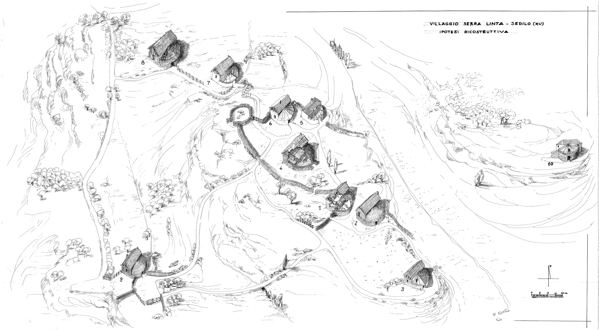
Village of Serra Linta
A prehistoric settlement with remains of huts, enclosures, and traces of agricultural activities, testimony of daily life in the Neolithic.
Village of Serra Linta
Village of Serra Linta
Contact
Access information
From the SS131 Diramazione Centrale Nuorese, at the height of km 10,700 (direction Nuoro) and 11,400 (direction Abbasanta), take the exit indicated by the sign “Lago Omodeo” and from here through a dirt road that proceeds towards S-SE you reach the current shore of the lake basin which coincides with the location in question; this was located in a bend of the Tirso, not far from the confluence of the Riu Iloi and the Riu Siddo.
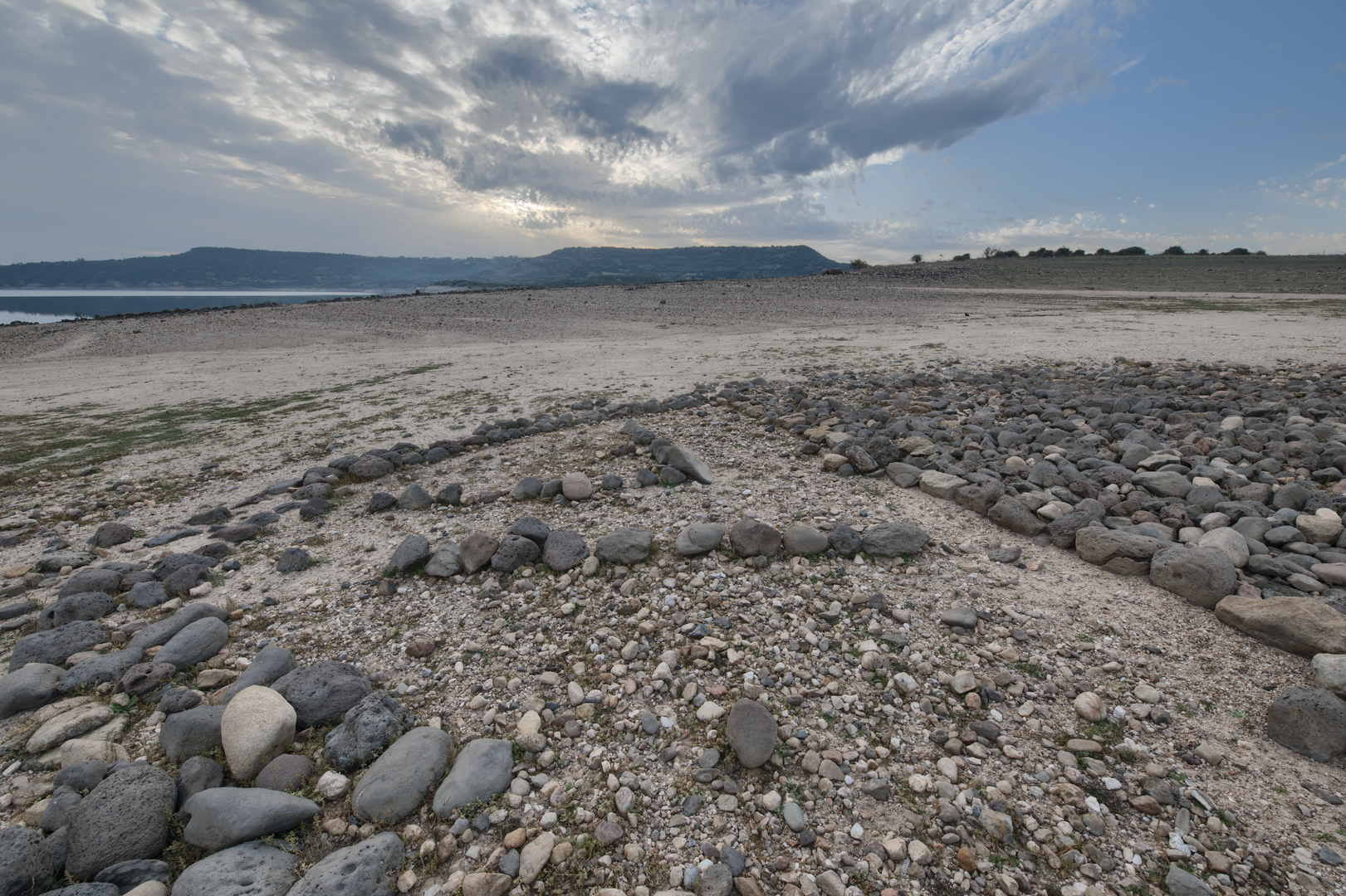
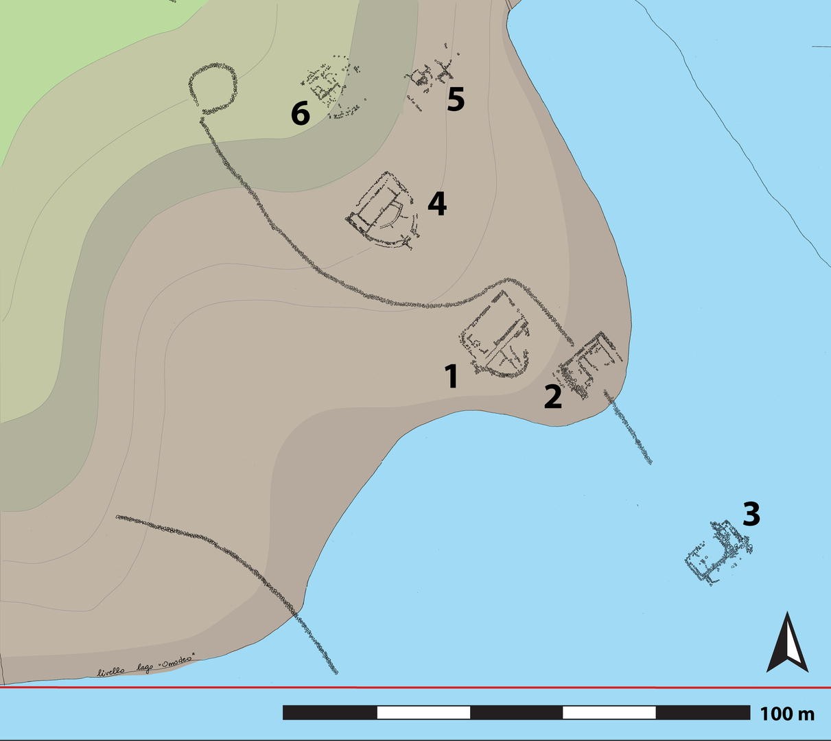
The village extends for over 40 hectares on the top and along the slight slope of a hill located in the Tirso river valley, in an area that is currently occupied by the artificial water reservoir of Lago Omodeo, where construction works were completed in 1924. The settlement extended in front of the river plain, at a bend of the Tirso river and near the confluence with Riu Iloi and Riu Siddo.
Following the discovery made by Umberto Soddu at the end of the 1980s, and confirmed by the surveys carried out in the same years as part of the project entitled “Iloi-Sedilo: the use of the territory from the Neolithic to the Middle Ages” coordinated by Giuseppa Tanda, the archaeological site has been investigated by several scholars who have described the structures and analyzed the materials uncovered during the surveys.
The area is characterized by the presence of several wall structures associated with a large number of artifacts made of stone and ceramic chips. In the absence of excavations, the study of these finds allowed the village to be attributed to the Ozieri culture.
The discovery of this vast settlement is of fundamental importance because it has allowed the identification of a construction model hitherto known only through its depiction within the domus de janas. The model is not found elsewhere in the Sardinian archaeological environment and, on the basis of the data collected to date, it is also unique in the European environment.
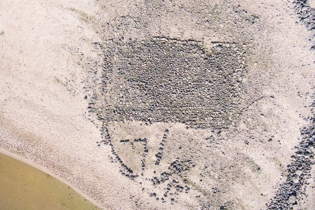
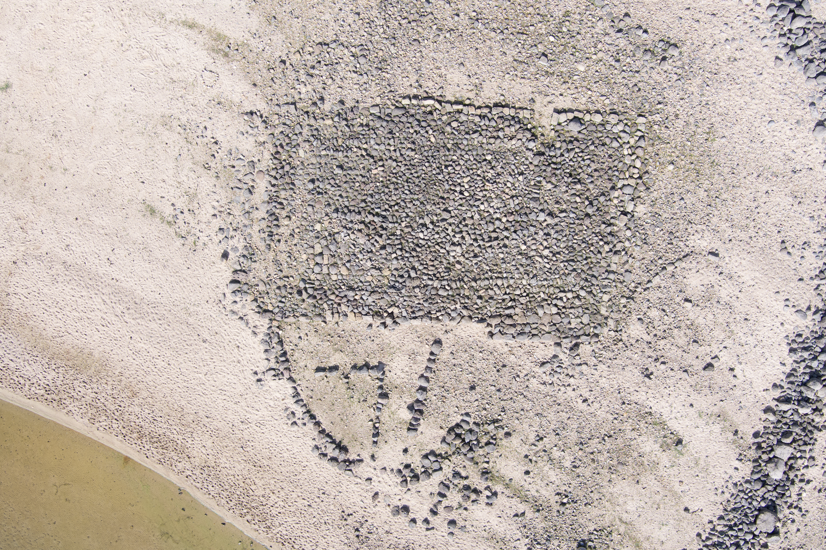
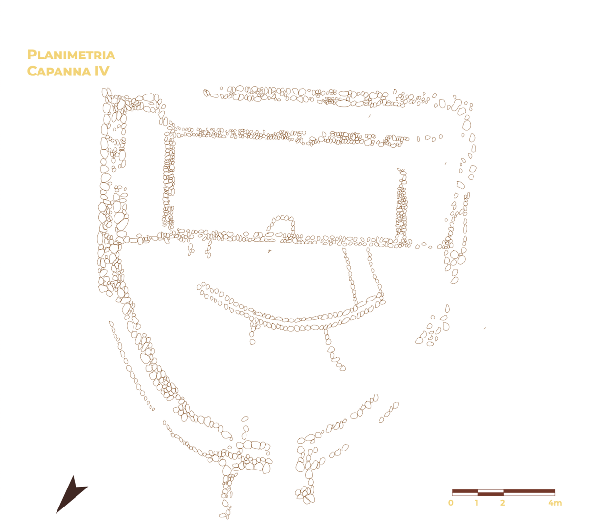
From the analysis of the environmental characteristics of the territory, a distinctly agricultural vocation of the area emerges, documented by a high percentage of land (43%) having an optimal aptitude for cereal farming within a radius of 2.5 km around the settlement. The intense agricultural activity practiced in the fertile soils lapped by the Tirso river is documented by the numerous surface findings of millstones, grindstones and polished stone pestles. The choice of the location of the settlement, on the valley floor and along the banks of the Tirso river, is, in fact, far from random and reflects a precise economic and cultural orientation operated by an agricultural society that preferred the positions on low hills (between 90 and 130 m above sea level) adjacent to the irrigated river plain. The best preserved structures are made of medium-sized stones on the basis of a module formed by two rooms, one rectangular and one semicircular one, adjacent to each other. Both are divided by further architectural partitions that can be hardly detected due to the small thickness of the residual elevation.
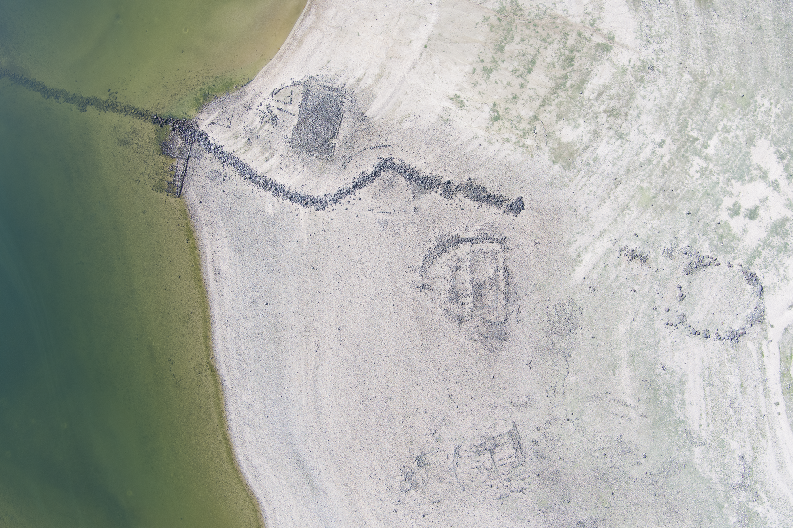
The layout of nine tombs characterized by the scheme described above and the plans of a circular hut and a large semicircular structure can be clearly seen; of the remaining settlement, only a few wall pieces remain, which are not enough to recreate its overall development.
The surface occupied by huts ranges between 97.8 and 287 m² (measured through reconstruction estimates), for an average area of 176 m², based of the calculations made on the remains of six structures; on the other hand, the extension of the large semicircular structure identified a short distance from the Tirso river, is considerably greater, for a total amount of 330 m².
At the southern edge of the settlement, currently flooded by the basin, another structure is visible. Only a basic row of blocks remain, partly well preserved but difficult to detect due to the pebbles and debris deposited over it.
The building is large: as a matter of fact, the western straight wall is 19.50 m long, while the semicircular part has an external radius of 20.50 m. The perimeter wall is double-faced with a wall thickness that reaches 1.70 m in the northern curvilinear section and 1.15-1.20 m in the southern one. The accumulation of small stones over it prevents from clearly following the development of the straight wall to the West and verifying the presence of a narrow corridor on that side; equally difficult is the identification of the traces relating to the internal partition of the large semicircular surface. The entrance to the structure was on the East side at the maximum convexity of the semicircular module, where an accumulation of stones can be seen, including traces of wall segments that may be connected to the presence of a vestibule or another structure that is now hard to decipher.
At the eastern edge of the settlement there is an area that has undergone the removal of a thick layer of archaeological deposit due to its exploitation as a sand quarry.
In the sections obtained by the quarrying activity, some areas of darker ash gray soil and with a large number of emerging materials, including obsidian, ceramic fragments, small bone remains and some shells, can be seen. No stone structures can be seen; however, some small pockets include a base layer of flat stones and medium-sized pebbles.
-(1)_plan.DVIN_MWH.png)
Bibliography
- Di Gennaro F. 2023, Il villaggio di Serra Linta, Sedilo (Or), in G. Tanda, L. Doro, L. Usai, F. Buffoni (eds.), Arte e architettura nella Sardegna preistorica. Le domus de janas (candidatura unesco 2021), Cagliari: 206-211.